






The North Sea is an important fishing ground for many European countries. Trawling vessels drag their nets behind them at varying depths, depending on which type of fish they intend to catch. Sometimes when trawling for bottom-dwellers like plaice & crabs, the nets pull up items that seem wildly out of place in the middle of the ocean.
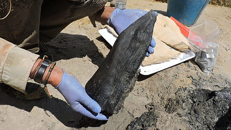
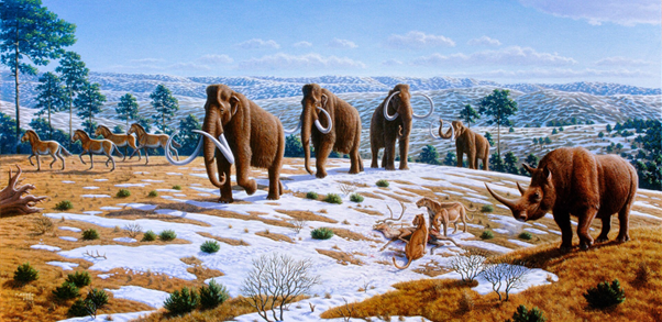
There are the teeth of lions, wolves & hyenas, the ornately armed skulls of bison & deer, the jaws of a sabre-toothed cat, the tusks of woolly mammoths & even hand-crafted stone tools. These relics clearly represent land-bound species of the ice age, but the North Sea is nearly 100 metres deep on average, so how on earth did they end up in fishermen’s nets?
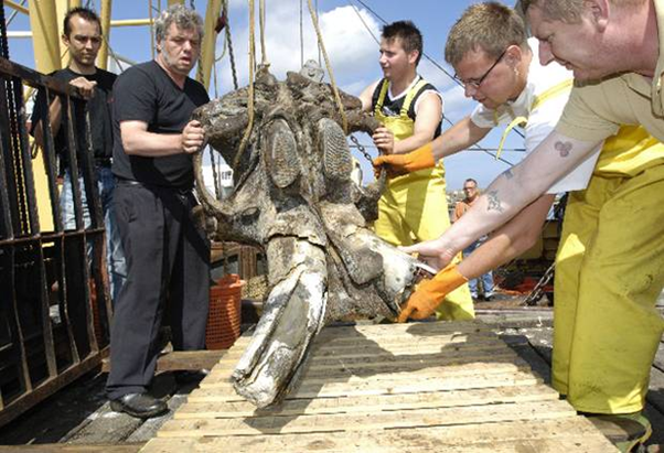
The skull of a Woolly Mammoth (viewed from below) being carefully lowered on the deck.
The key to this anomaly lies in the dramatic changes in geography seen during the last ice age. Formally known as the Quaternary Glaciation, this age of exaggerated cold began around 2.5 million years ago & went through several waves of glacial & interglacial periods, where the massive ice sheets that dominated the northern hemisphere routinely expanded & retreated over the course of several thousand years at a time.
These occur as a result of the Milankovitch Cycle, in which small variations in the Earth’s orbit affect its distance from the sun & the angle of its axis tilt. During their peak, the glaciers locked away vast volumes of water, causing global sea levels to drop by as much as 120 metres. This meant that shallow seaways shrank away to reveal dry land, creating open terrain that was accessible to land-dwelling creatures. The North Sea was one of these lost seaways, becoming an open plateau of grassy tundra known as Doggerland.
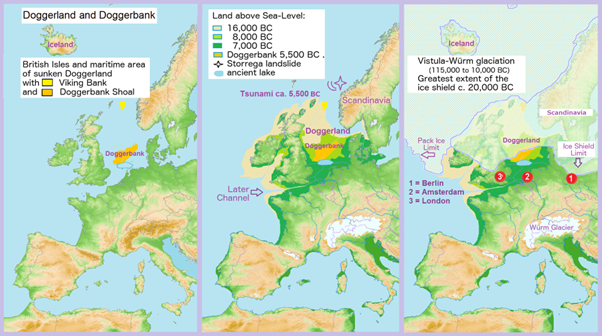
The British Isles were united as a single land mass with mainland Europe, & it would have been possible to walk from Norfolk to Amsterdam without ever touching the sea. This provided a route for animals on the mainland to migrate freely across the now unified European continent, which is why much of the wildlife in the British Isles is also found in mainland Europe, including the extinct fauna of the ice age & the earliest human settlers.
As the climate warmed & the ice caps began receding around 12,000 years ago, Doggerland began to slip away into the ocean. This was mainly due to the rising sea levels, but also as a result of post-glacial rebound. When the ice sheets were at their maximum, the massive weight of the ice actually compressed the continental plate beneath them.
When the ice disappears it relieves that huge pressure, causing the crust to slowly spring back upwards. In most cases this causes the land to slowly increase in altitude; Scotland for example has been rising by about 1-2 millilitres per year. However for Doggerland this tectonic movement proved to be a source of instability, & what little land was left above sea level soon collapsed in a great cataclysm of landslides & tsunamis, disappearing beneath the waves around 7,000 years ago.
Doggerland was just one of many land bridges that have sunk into the sea since the end of the last glacial maximum. The island chains of Indonesia were once one great peninsula known as Sundaland, while the Bering Sea between Siberia & Alaska was a dry passageway between the two continents. There are almost certainly fossils & artefacts sitting deep in these now subterranean landscapes waiting to be found & tell the story of their ancient past.